Friday, June 29, 2012

A Few Pictures from Lottis Creek

About 1/10 of the way in, you randomnly enter a Wilderness Area.  Mountain biking becomes prohibited.   Nuts, cause otherwise I'd totally be biking this.  (sarcasm font)

The White & Lilac Columbine: CO state flower.  MMG should be happy I didn't pick any!

This sort of looks like a Thomas Kincade portrait, no?


Rainy Beaver Pond
That's about all the pictures I have.   We need to take some more pictures, it seems.  :-)

Thursday, June 28, 2012

Lottis Creek Trail

June 26-27, 2012

Tuesday-

This morning Missy got suited up for a hike on the nearby trail: Lottis Creek Trail.    I stayed back in camp with the elderly Budster and had a campfire.   The people next to us in the campground hung a hummingbird feeder.  At first, the birds were fun to watch.   However, their loud buzzing and territorial fighting quickly becomes tiresome.    It is amusing to see some of the hapless hummingbirds fly into our garage, drawn to the colorful kayaks.  

Missy came back limping after about 3.5 hours.  She said the trail was difficult for someone with weak ankles.   Lots of R&R.   (rocks and roots).    She also got some big ol blisters on both heals.  Ouchie.   However, it sounded like a neat hike to try out, so I made formal plans to go myself the next day.

The electricity went out for a couple of hours around noon.   According to the camphost, the nearby road constructors had to cut the power lines when digging ditches (one of the most dangerous jobs in the world, according to my older brother) and laying new lines.     I was a little concerned that this might be a daily thing.  We’d been planning on being able to leave the dogs in the heat of the day for some day trips.  Without being able to count on A/C for the dogs,  they could get too hot.   Hopefully it doesn’t happen again.

After dinner, we had ourselves another campfire.   The camphost told me today that there is now a complete fire bad in effect.   Until now, there was a partial ban whereby fires in established campgrounds were allowed, but no fires for dispersed campers.   It’s terrible to read about the Colorado Springs fire, so I am fine with the necessity of the total ban.   With the ban going into effect at midnight…we had to get our last fire in.   I got out the clippers and made use of the brush trimmings that litter the campground.   Some clearing was done all around the campground before it opened, and the wood was left on the ground for the enjoyment of the campers.

Wednesday-

Today was my day to hike Lottis Creek trail.    Missy had told me about how it had taken her about 1.5 hours to go up 3 miles.  I got detailed descriptions of markers along the way: cows, cowboys, ATVs, an open meadow.    She said the whole trail was 
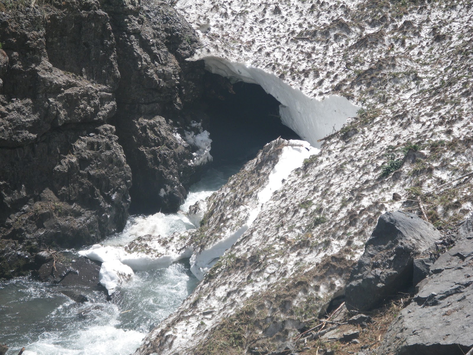
creekside, with lots of great scenic pour-over sections to enjoy.   There is a lake at 6.5 miles which is supposed to have lots of fish for the catching.   I didn’t think I’d have the urge to make it to the lake, but I was determined to get further, faster than my twin.   With that goal in mind, I set off with Cassie in tow.  (Or vice versa).

I set off at a brisk pace and kept it for most of the way up.  The trail was narrow and rocky, but it gently gained elevation, so the going was fine.    I made great time, or so I thought.   After 2 hours, I still hadn’t reached the markers that Missy talked about.   I was incredulous that Missy had beat me with her bum ankle, but I assumed that had to have been the case.  I did the math, and it seemed that if the 3 mile marker was still ahead of me somewhere, then that meant I was doing WORSE than a 45 minute mile.  WTF????   My leg muscles were extremely sore and so, defeated, I turned around.   I had planned to stop on the way down at this neat section of 4-5 beaver ponds for a break.  I was hopeful that I’d get to see some of them swimming around.   But alas, the weather turned stormy and I got rained on instead.   Luckily I had an umbrella with me, so I was able to keep moving back towards camp.   After being out for 4 hours, I finally limped into camp.   

When I compared hikes with Missy, it quickly became apparent that we’d taken different trails.  The main thing we both fixed on was the fact that the trail was creekside.  What we didn’t know was: there are 2 branches to Lottis Creek.   Duh!    That explained why I hadn’t seen what Missy had seen.    So now I’m curious about how far I actually went.  Am I in shape enough that I might have gone almost to the lake (6 miles) in 2 hours?   Hmmm.  

 I have to give a shout out to the National Forest Trails.   When we first started thinking about taking our adventure trip, we talked about visiting national parks.  However, when I found out that they don’t allow dogs, I knew we’d have to be camping elsewhere.  So we turned to National Forests.   I can’t recommend them enough!   The trails are usually crowd- free, and they are dog friendly.   And so far the scenery hasn’t disappointed.     I now can’t imagine picking a crowded National Park hike over a tranquil National Forest hike.  

From about 2pm to 4 pm today we had scattered thunderstorms.   It was neat to listen to the thunder.   The rain was light and only lasted about 15-20 minutes.   It was enough to raise the Taylor River from 300 cfs to 304 cfs.    Grrrrr.    After the thunderstorms cleared out, it was sunny and nice again.    Yesterday,  Missy saw a post on MountainBuzz about how the Taylor River was still a fun class 3 run, even with the water so low.    We decided we’d go scout the put-in and take-out after 6 for a future run.    See, the last camphost told us that the road construction stops at 6 pm and on Sundays.  So we figured the road would be clear.    Sadly, we were misinformed.   Either that, or the crews were working late just this once.   Sigh.

30 minutes of waiting each way.   And we were only going 5 miles.    We found the listed site for the put-in, but it was right in the middle of the construction zone.   It looked like the parking area was being used as a staging zone for the equipment.   Missy though maybe there was still a spot she could park the scooter.   See, the tricky part about finding put-ins in Colorado is that the private land owners are fanatical about keeping people off their land.  So trying to put on somewhere besides the sanctioned sites is a serious offense.   At the take-out, there was a map with rapids descriptions and put-ins/take-outs for about 4 sections of the Taylor.   One section listed a put-in at our campsite, Lottis.   However, there were harder rapids for that part.  So we aren’t sure about starting at camp or not.  Plus, there’s barbwire fencing for the cows everywhere that I see.   I don’t know how you get your boat to the river, unless you chuck it over and then do the high jump over the fence.   Maybe we’ll take a closer look tomorrow.   We don’t know if we’ll try setting shuttle and kayaking whilst construction is going on, or if we’ll wait till Sunday.   The only thing we know for sure is that we are definitely going to get us some, finally!!!!!

Tuesday, June 26, 2012

Taylor River Area


June 23-25, 2012
On Saturday, we went for a drive up the road from the Taylor Reservoir.   We wanted to scout possible boondocking sites to move to.   There were several nice spots with decent roads and privacy.   However, Missy was NOT feeling it.   She wasn’t a fan of the scrub-bare mountain top views.    I thought it was okay, especially for being free.   But she really didn’t like the area, so we headed back to camp.    I then spent  a lot of time researching new spots on the internet.   I looked at the Crested Butte area, because that’s where OBJ is and we really liked that when we visited a couple of years ago.   There are 2 forest service campgrounds in the area, and ZERO private campgrounds.   I found that to be strange.   The first non-rv friendly town in Colorado.    One forest campground didn’t have sites big enough to fit us.  The other had 6, and they were all first-come-first-served.   I was nervous about making plans to head for that campground without the possibility of a private campground to go to in case it was filled up.    But, we weren’t inspired to move anywhere else, so we decided to leave for Crested Butte the next day.

Sunday- I had a lot of anxiety about the full campground scenario.   So I thought it would be worth it to check out the nearby campground to see if the scenery was more to our liking.   Well, not just the scenery.  We were looking for some place with trails for hiking and/or biking.  Lakeview didn’t have any.   I made the arduous 5 mile drive down to Lottis Creek Campground (another one of the 7 or so Forest Service Campgrounds in the Taylor River Area).   What a difference!    Going back down the mountain, just passing the reservoir, and things changed dramatically.   The area was gorgeous, more trees to enjoy and majestic mountain cliffs.   I checked out the campground.  It’s got about 26 sites in 2 loops.   All with electric.   Luckily, this campground is newly renovated from last year, so it’s not set up for reservations yet.   First Come-First Served!   Yay.   There were lots of sites we could fit in.   One loop had great shade, but that meant limited mountain views.   Plus it was next to the main road.   The other loop had hardly any shade, but that means great views!   No shade is less of an issue when you have electric to run the A/C.   Plus, there was a trailhead right at the campground.  So, even though the privacy is sparse, this will make a great home for the next 2 weeks.  Yippee!   I’m so glad I decided to check this out.   I went back to camp and told Missy we only have to move 5 miles.

 We decided to spend one more night at Lakeview.   We had thought that the campground would clear out with most people leaving on Sunday.   That meant we’d get the place to ourselves to enjoy the quiet forest ambiance and relax in the shade and breeze.   But…strangely it was just as busy with new arrivals on Sunday.   And one mean group left their generator running all day while they were away fishing.    Bummer.


Monday-

5:45 am.   I am slowly awakened by a repulsive smell.   I realize one of the dogs has had an accident.   Yuck to the power of 1million.   I had to get everything cleaned up and scrubbed, so there was no chance of falling back asleep.   I decided to have a fire since I was up so early.    One (and only one) benefit to being so crudely awakened that early was that I got to enjoy seeing a herd of deer move throughout the campground.    This forest has zero undergrowth, so you can see clearly for several hundred yards.  This herd had about 8-10 members, some males with nice antlers.   It was very neat to be able to watch them for about 15-20 minutes.

We stayed at Lakeview until lunchtime.  Then we had an easy packup and hookup for our big trip.    We topped off our water tanks, since we have the chance.   We probably wouldn’t run out in the next 2 weeks, but since water is available we may as well load up.   The trip to Lottis was our easiest yet!    We should make a point to only move 5 miles at a time in the future.  :-)  We picked out our site…one of the 2 at the very back, furthest from the road.   There are TONS of chipmunks around.  It sucks, because there is a barb-wire fence bordering our site.   It’s to keep the cows out(!)   I guess the forest service leases grazing rights to ranchers.  So the ranchers drop their cows off many miles down the road and then the cows move on their own to a mountain meadow.   This fence is concerning, because it wouldn’t be unlike Cassie to try to go dashing under it in pursuit of a chippie, and rip her flesh open in the process.    We’re going to have to keep her on leash pretty much all the time.

We got ourselves setup in our new home.   We’ll be here for 2 weeks.   We hope to make day trips to Crested Butte and Gunnison.   We might also check out the Cottonwood pass, which is the shortcut to Buena Vista.   We’ve heard it has some serious switchbacks, so we’ll need to check it out to see if our RV can make it.   If it can, we’ll save 60 miles on our way to BV.  (Missy is holding out hope we’ll be able to kayak the Ark…she wants to check out the play park.    Of course in MN, there had been 100 year floods raising my hometown rivers to previously unseen levels.    So sad about the destruction there.   Why must it be feast or famine with water levels?)   The sun here was, as expected, wicked hot.   It got into the 90s.  We escaped into the A/C for most of the afternoon.   Once the sun started behind the mountains, I took the bike to check out the trail.    Disappointed!   It’s for expert bikers only.   Lots of rocks to avoid.  I just can’t summon the skill to maintain speed to steer.    Oh Well.   It should be good enough to hike these trails.    Since I got skunked riding the trail, I went ahead and checked out going on the main road.   It was fun to be able to ride on blacktop instead of dirt.   I only went about a mile before turning around and heading back.    I think riding on the main road will be a great option for some exercise while we’re here.

Saturday, June 23, 2012

On The Move

June 20-22, 2012
Wednesday-

We got packed up and ready to move out from our campsite by 10:30.   We had received a call that the tire would be in by 11 am, so we wanted to get parked and disconnected at the RV park in time.    It was a short drive to the Red Mt. Campground – about 10 minutes.    We got checked in and disconnected, and then sat around waiting.   We utilized the hot showers and did some laundry.   Finally at around 5 we got a call that the tire was in.   Since it was closing time at the repair shop, we made arrangements to bring the truck in first thing Thursday morning.

Thursday –

Got the truck in by 8:45 and the new tire was done by 9:15.    I asked for advice on tire inflation and got the 3rd set of different advice from professionals.   Sigh.  But, since this guy regularly services pickups and knows about pulling RVs, we’ll follow his advice.   We’ve probably been keeping the inflation too high.   We dumped our tanks and got hitched again.   Pulled out at around 10.  We’d decided to just head for the Taylor River area and try to find a spot at one of the many pay forest service campgrounds on 742.    We’d called and found out that there was water at Lakeview, so Missy said we should start there.   Even if we couldn’t find a spot there, at least we could fill the tanks.    By waiting to fill with water, we saved ourselves having to travel the mountain passes with that extra billion pounds of weight.

I was nervous about driving the rig through the mountains, but it went fine.  I utilized engine braking as much as possible to save the new brakes and rotors.  It went pretty smoothly.   We stopped at the grocery store in Montrose and then continued on towards Alton.   When we turned onto the forest road to head to the campground, we encountered the road construction.    We had read about the construction, but didn’t realize the extent of the delays.   There was a 6 mile stretch of work being done, and the workers were scattered on the WHOLE 6 miles.   They had the one lane at a time deal going on…but instead of only for a short .5-1 mile section, it was for the WHOLE 6 miles.  We actually waited for 15 minutes for our way’s turn to go.   They had a pilot car to follow, and he made us stop 4-5 times along the way for 2-5 minutes at a time waiting for loaders to get out of the way, or for dump trucks to load up, or other random stuff.   It was not pleasant.    Missy started to get frustrated and lament our choice, but I just reminded her that we had the time to spare.  :-)

We had some issues with Karen and Jane not knowing where we were or where the campground was.   But we finally saw the sign for Lakeview at around 4:30.    We drove around and chose a spot.  There were some nice electric sites with views of the “lake”  (reservoir).   However, with sunny skies and temps into the 80s, we needed to find a shady spot.   So we have a non-electric site with a nice shady yard.   We unhitched and tried to level the rig.  Oops.   Couldn’t get low enough.   So we had dinner and then went about re-hitching and backing up about 10 feet.    Bingo.    We sat in our loungers for the rest of the evening enjoying the warm breeze and the absolute silence of the forest.

Friday-

Today was a lazy day.   We relaxed in our loungers and read most of the day.   Missy harangued Josh into finishing a Scrabble game that I’d abandoned.    It was kind of amusing.   She would text Josh his tiles and a picture of the board for each of his turns.   Pretty impressive that he could play without an actual rack to move tiles about on.    We didn’t get to ride bikes because there are no trails at this campground.   And the campground loops themselves are very steep and curvy.  It’s interesting how much we’ve enjoyed riding bikes and how now we’ll have to evaluate new campgrounds for riding options.

Friday, June 22, 2012

Final Pictures from Silverton

It's possible Cassie sees the squirrel in the tree.

Tina in front of a waterfall

Missy looking down into the abyss

Missy looking up at me


Spotting her line through the wood


Looking for dropped keys.  Just kidding!

Wednesday, June 20, 2012

Ice Lake Basin Trail

June 17-19, 2012

Sunday –

Missy decided to go hike the Ice Lake Basin Trail today.  This trailhead is right by the pay campground at the end of our forest road.   It seemed like it was a popular hike, because each time we rode our bike to the campground that parking lot was always full.   We had a brochure that showed the trail on a map, but it didn’t give any information about how long the trail was.    Since I was feeling lazy, Missy went pioneering by herself (well, not completely by herself because Cassie went along).

While Missy was away hiking, I was getting busted by the fuzz.  Kinda.   Today was the end of our allowed 14 days, and at 3 pm the ranger came by.   I explained our issue with the tire and how it won’t be here until Wednesday.  He seemed like he wasn’t too excited, but in the end he said he understood that emergencies happen.   I chatted him up a bit and we parted on good terms.   When I told him how we’d been looking for the rapid from our book, he was shocked that Lime Creek road was listed as a run in printed literature.   He knows it, of course, because it’s part of his beat (there are free campground sites on that road).   I guess he’s never seen kayakers there and I showed him the pages describing the run so he’d know what we’d been looking for.    Strange.   The book did mention that getting on this run is tricky.   You need perfect luck to find the sweet spot whereby there’s adequate snow run-off, but yet not too much snow that the road is unpassable.   Stupid Lime Creek Road.

Missy came back limping and busted up at dinner time.    She had a minor accident on the way back to the car, within sight of the car.   Tee-hee.   Is it mean to laugh?   She said she looked up from the trail for a second and then stepped on a rock, which twisted her weak-as-newborn-kitten’s ankle and caused her to skid in the gravel.   She has a nice road rash on her shin.  She also had tales of an amazing trail. 

We looked this up later, but we found that this trail is described as having the best views in Colorado.    That’s really saying something.   Missy said the hike was amazeballs.   You get to start out in the forest, and make your way up and into clearings with 360 degree views.   Then you go back into the forest for peekaboo views of cliffs and waterfalls.   The climb is just as high as our epic mountain climb from earlier.   So it’s tough and slow going on the way up.   Missy mentioned the weird behavior of mosquitos on the upper forest trail.   She said when she stopped for breaks, they would swarm her and she’d be covered.   But as soon as she started climbing again, they disappeared.    Missy had to turn around before she made it to the end of the trail because we had dinner plans.    But since this hike sounded so incredible, I was determined to hike to Ice Lake the next day.

Monday-

For some reason, we got up super early today.   Since it’s cold in the mornings, we passed some time playing scrabble.   I wanted to wait until it got to at least 50 degrees before heading out for my turn on ILBT.  I finally got underway at 9.    The weather was perfect, and the trail was mostly empty.   (On Missy’s hike, she passed lots of people).      This hike…is incredible.   What an awesome display of nature, just there for the taking! 

-Such a surreal experience…the trail in spots was so narrow and was perched next to a sheer drop-off that you literally could not take your eyes off the trail.   I once foolishly tried to look up and around at the mountains, and I almost went down the drop-off.   Strange to have to actually stop if you wanted to take in the scenery.

-It was amusing to see that Missy described the mosquitos correctly.  I’ve never seen anything like it.   On that super steep section, I’d be sucking wind after 10-15 feet.   But like Missy said, if you stopped moving, the squitos came out.    But when I got moving again, I was sooooooo slow.   There’s no way a MN mosquitos wouldn’t have gotten me while I was moving.   I wonder why they didn’t attack when I was moving?  It turned out to be a great motivator to get your butt in gear again quickly!

-After 1hour50minutes, I finally made it to the huge basin clearing and ice lake.  Or so I thought.   At that point, there wasn’t any one around.   I knew there were 2 teenage girls ahead of me, but I didn’t see them anywhere.   I finally decided they must have made it to the tent that was across the meadow.   I sat down to enjoy the day, and then I spotted 2 ants moving up the mountain across the way.   It was the hikers…the trail continued on!     I was bummed that I wasn’t at the end of the trail, but I wasn’t at all tempted to go on.    The proportions in Colorado can be mindbending.   While the meadow and the opposing cliff seemed small and intimate, the meadow must have been a mile across.  (Basing this on several other pairs of hikers who came along and how long it took them to cross).    As we read later, the trail makes a dramatic and somewhat dangerous turn up at that point.  You gain a ridiculous amount of elevation in a short period, and have to manage it on a scree-type surface.   I sat in the basin for almost an hour, and those girl hikers never came back along down.   So it’s got to be a long way to the end of the trail.   Later, I googled the hike (to see the trail map and deets on distance and elevation).  It sounds like I missed out on even more amazing stuff, with cascading waterfalls and fields of wildflowers.  Drat.  (Here’s the link, if you are inspired to learn more:  http://www.trimbleoutdoors.com/ViewTrip/497596 )

-I have to say, not having a snowpack this year is a mixed blessing.   While it sucks to not be able to kayak…without this dry patch we would not be able to enjoy these fantastic hikes.  As the ranger pointed out to me…usually at this time of the year, this campground and the trails are still snow covered.   So we’ll take the pain of no flowage in exchange for enjoying Colorado on dry land!

Tuesday-

Our last day at Sultan camp.   Sniff.   It will be tough to leave this amazing site.   To commemorate our last day, we drove to the end of the road and parked to walk up the creek.  This is the same hike that Missy did way back at the beginning of our stay.  It was hot today, so a waterfalls hike is just the refreshing activity called for.   I had seen the pictures from Missy’s hike, but like I’ve been saying all along, pictures just don’t do justice.   I was delighted with the hike, each level up offering a new waterfall and a new vista to the ones we’d just visited.   We spent a couple of hours enjoying the views and hiking up and down the couple hundred yard stretch.  I really started to get sad as I looked around at the views for the last time.   I worry that no place we visit in the future will compare with our time in with our time in Colorado.   Are we spoiled for the rest of the country?  I did posit that perhaps we wouldn’t care so much about surroundings if we found a place with whitewater.  :-)   I would have been happy to spend the rest of the day staring at the water, but Missy got whiny about the mosquitos and biting flies.  So we headed back for camp.   
Tomorrow morning we will pack up and move to a private campground in town.   We will dump our tanks, possibly fill up on water (depending on if our next destination has water or not), do laundry and take long hot showers.   We will research and make a final decision on where to head next.  We will also get our new tire installed.   Thanks to the National Forest Service for sponsoring these 17 days in paradise!

Monday, June 18, 2012

The T.A.H.N.G.V.B.D.


June 15-16

Friday Sucked Ass:

We had an innocent enough objective: drive out to take a look at the Lime Creek run.    It was described in our book as a steep and exciting class 5 run.    Now, we were sure there wasn’t going to be much water, but we still thought it would be a nice hike to look at Adrenaline Rapid.  There was not a hint, a whiff, an inkling of the terrible road conditions on Lime Creek Road.   Sigh.  

We saw the sign that said “Rough Road: 12 miles”.     But we’ve seen those signs before and they’ve just been to advise bigger potholes or the hated washboard striping.   Those can be annoying, but survivable.    This road…this road was hell on earth.   It was like driving on shards of glass with soccer sized rocks placed strategically for maximum pain.  We could only go about 1 mile per hour.   We were having a tough time negotiating all the big rocks because of those stupid low-hanging sway bars.   After an hour or so, we came to a seemingly impassible spot around the halfway mark.   Newly fallen boulders created a narrow slot that made you come within centimeters of the cliff edge.    Clearly other vehicles had been passing by, but our truck was just too big.  We lined up and barely got the front tires between the rocks, and then we had no room to move to clear the back tires.   Missy had clearly had enough, saying “I can’t go back”.  (At that point, we were still holding out hope that the road got better “just ahead”, which is why we never turned around).   The passenger rear tire had to come up and over a sharp wedge point.   I held my breath…and it turned out okay!   I got some pictures, but I don’t think you can appreciate the horrible sharp rock, nor how close we came to the edge.

At this point, we were both mentally drained from the tense ride.   We agreed we were giving up on seeing the run: we just wanted to get out of that minefield.    As we were slowly making our way up the road, we heard it.  POP…HISSSSSSSSSSSSSSSSSSSSSSSSSSSSSSSSSSSSSSSS.   I can’t even summon the energy right now to describe how totally and completely horrifying the feeling was that we were going to have to deal with yet another ruined tire.   We limped forward to a rare shoulder area and started to deal with the flat.   Missy was pretty chill with the whole ordeal.  I was on the edge of tears, so if she hadn’t have held it together so competently, I’m sure we would have Thelma and Louise’d it right then.  I mean, COME ON!   A brand new set of 4 tires purchased when we got this used truck.   And this newly ruined tire represents the 4th and final ruined tire of the set.   I can’t even imagine what it’s like to have a tire last its normal lifespan.   It must be magical.

Changing the tire was painful.   We didn’t know where to put the jack.  I had no reception, so I couldn’t call for help.   We had 2 jacks, and we must have tried 6 or 7  placements.  We just couldn’t get the truck high enough to clear the tire.   Finally we got a big rock, and jerry-rigged a set up to raise the jack.   I’m sure it wasn’t at all safe.   We’d been there about an hour and hadn’t seen a soul.   Just as we got the jack working properly, then 2 sets of hikers and 2 jeeps passed by.   Why couldn’t they have shown up at the beginning?    Anyway, we got the flat tire off.  Then we tried to put the spare on.   Sigh.   Those of you who’ve changed your own tires before probably already knew this, but you need MORE clearance to get an inflated tire on then you need to get the deflated tire off.    Lesson learned the hard way.    We were at the end of the jack…it would not go up more.    I tried getting a big rock and digging a hole, but the dirt was hard packed and it wasn’t working.   So…we lowered the jack again and inserted something else beneath it.  Finally got the needed 2 extra inches and got the spare tire on.    We were dirty and tired and depressed…and we still had 5 more miles of this horrid road to go.    It was even worse agony from this point on, because we were sure that each rock that was unavoidable was going to puncture another tire.   But we made it out at last.

We drove straight to the repair shop (the one that did our rotors/brakes…which work AWESOME!) and went in to buy our 4th tire of this trip.   Big surprise, they didn’t have our tire in stock.   Worse, their warehouse didn’t have any in stock either.    We went outside to look at our atlas to see about going to a bigger city while the technician made a call to see how expensive it would be to UPS our tire.    Finally, a bit of luck…there was an established freight run between Denver and SLC, so to drop off a tire would just be $3.50.    We went ahead and ordered the tire.   The issue is, it won’t be here until Wednesday.   We only get 14 days in the National Forest campground area, and that time is up on Sunday.    We figure we’ll ask the ranger for an exception to stay until Wed.   There’s such light traffic on Mon/Tues/Wed that we hope he’ll agree.   If not, we’ll have to move to one of the private pay campgrounds in the city.

Saturday –

Today was a recovery day for us.   We went for bike rides in the morning.  After lunch, we went to town to go to the library.   We stayed at the library until closing time, and then headed back to camp.    I wanted to have a campfire, because it was a calm night and the upcoming days are supposed to be windy.   But, since our across-the-creek neighbors were blaring their radio, Missy didn’t want to.   So I went ahead and had a campfire for one.   It was annoying to hear the radio, but otherwise it was a relaxing and peaceful way to recover from the previous day’s stresses.

Sunday, June 17, 2012

Happy Father's Day, Dad! I got you some pictures from our trip to Ouray!

How scary is this road?  That's a shear dropoff there, with a blind curve for added enjoyment!

Pointing in case you can't see the rapids

I love how the colors turned out in this one!  Green trees, brown mountain, blue skies and white clouds.

Snow culvert!

Missy upstream of the snow culvert

After the culvert calved

Scenic Overlook

Skinny waterfall in the background

HUGE Waterfall.  Doubt you get the idea from this inadequate picture

I love this shot. It seems unreal, like looking at a 3D poster

Saturday, June 16, 2012

This is another Picture Post!

Missy uses artistc license to frame the Moose all the way to the left

Moose!

This is the mountain we climbed.  See the lower left quadrant for the waterfall and switchbacks

A great shot from our hike to the rapids

Missy's feet

See Tina in the red?

Who wants to run this with us?

Friday, June 15, 2012

Ouray is Da Bomb Diggity


June 13-14, 2012

Wednesday –

The plan for today was to travel up 550 through Ouray, check out some campgrounds, and then continue on to Montrose for some WallyWorld shopping.   But first, we got in our bike rides.   It was a race to see who could ride to the end of our forest road and back first.   I think it was pretty much a tie.   On my ride, I was feeling all proud and accomplished by how noticeably my fitness had improved.    I decided to ride up the toughest hill without taking a break to prove my incredible fitness.   But then, the GSM said “in your face”, literally.  And forthwith came a strong and unending gust of wind.  I was humbled and had to stop partway up.    At least there’s a great waterfall there to look at while one tries to catch one’s breath.

We headed out on the road after lunch.   We did a little research into possible campgrounds in Ouray.  I didn’t actually find anyone who mentioned any boondocking sites.   However, there were a couple of forest service campgrounds (pay spots).   Up until now, it’s been our experience that where there is mention of the pay campgrounds, there are lots of free sites on the same forest roads.   So we were hoping we’d find something like that in Ouray.    The drive itself was an adventure.   This stretch of road is mentioned as particularly hairy and scary.  With narrow lanes, bendy roads and steep drop-offs, it was sure to be something to write home about.  I was nervous enough as it was, since this was my first time trying to be diligent about using engine braking and not brake-braking.   The roads were very windy, but I think much of it has been improved since the posts we read.   It was a fun ride more than a scary ride.

The arrival into Ouray….holy mackerel.   It was sub-par.*  The mountain ridges staked one in front of the other, created this really strange effect of some kind of super-sight.    I told Missy it was like we were viewing it with 3D glasses.    I tried to get some pictures, but I don’t think I captured the essence of what these mountains look like.    Just when you think you’ve seen the best of Colorado, there’s even more around the corner!    One funny story from the drive: we came upon some road work.  They were doing some “rock work”, which involved having a large crane set up in one of the lanes.  This means they were doing the one-lane at a time using flag-men.   I was stopped first in line at the stop person.   We were on the down-hill side of the mountain.  As we got the go-ahead, I proceed slowly.   I had been going only the posted speed limit the whole way up till this point, to the apparent disgust of the driver behind me who probably wanted to go twice as fast.   Anyway, at the point where the crane was, they had another woman holding the slow/stop sign.   I think she was there in case some rocks dislodged and suddenly blocked the road.   So I go by, in D1 at probably 15 mph, and she mouthed a big “Thank You” and gave us a thumbs-up.   As we got near, she said “thank you, finally, for someone going slow!”.    It made us laugh.  Probably not the guy behind us, though.

As we drove into Ouray, we saw the sign for the forest campgrounds.   At first we shied away from exploring it because more roadwork was going on, and we didn’t think it would have been possible to get the rig through the construction.   But then, we figured as long as we were there, and the mountains were so gorgeous, and since we had working 4WD, then we should go exploring.   So up we went.  It was a bumpy and exciting ride.  Here were the scary windy blind turns with steep drop-offs that get the heart going.   We passed the 2 forest service campgrounds, and both were tent only.   There were no free sites on that road.   I was MAJORLY bummed.  This area is so pretty that I would have loved to spend a couple of weeks here.    We continued up, craning our necks and absorbing our surroundings.   We stopped at one spot that overlooked some rapids.**   (There are probably 50 places that rent jeeps in Ouray, so there was a steady stream of traffic up this 4WD dirt track.   Of all the people, I think Missy and I were the only ones evaluating lines).    This waterfall was interesting because it was headed by a huge snow culvert.  There was a small cut out in the middle (kinda like a tunnel of love thing) and all the water flowed through that small opening and then down through the rapids.  We got some pictures and a video.   After we’d been there a couple of minutes, one side of the snow culvert calved right in front of us!   It was pretty neat.  So I took an after picture too.    The newly loosened snow hunks showed us what the line would be: river center into an immediate pin on the wood.  :-)

We drove up again for a couple of minutes. I wanted to go all the way to Yankee Boy Basin, which is supposed to be a lovely spot filled with wildflowers.   But Missy started to get carsick from the jostling, so we turned around and headed back.    Driving through Ouray, it’s another example of a quaint mountain town geared for tourists.   (Ouray is the Switzerland of America).  It was another 30 minutes to Walmart, where we completed our shopping and headed back home.   The drive back was as scenic as the drive in.   Maybe more so…we pulled over at a scenic overlook and were surprised to see a ginormous waterfall!   It was not at all evident when we had driven over it the other way.    There was a platform built out over the mountain side to facilitate viewing of the waterfall.  It was made of grates.   I was terrified, but I edged my way out onto it so I could enjoy the view.    All in all, this was a great outing, and if you get the chance to drive through Ouray, I’d highly recommend it!

*Happy, Josh?   See his comments from my “It’s Acceptable” post if you are confused. 

**Ask me in person sometime about the funny story of how I scared the crap out of Missy here.

Thursday, –

Today was a designated lazy day.   The weather cooperated, and we had a lovely warm breeze most of the day.   (Yesterday we got the weather on the radio on our drive.   Found out that nearby areas are into 90s in the daytime and 60s for the overnights.   Made us grateful for our nice high spot where the dogs are comfortable and we don’t have to worry about running A/C.   Oh, and we heard about the wildfire in the Fort Collins area.   I guess this is a massive fire raging in the Cache le Poudre area.   We kayaked that last year and loved it.   We had been considering trying to fit it in again this year on the way home, but I guess now that’s out.    I hope the destruction is kept to a minimum).  Around 11ish, I decided to take the dogs for a walk across the creek.   Up until this morning (when tent campers were gone before 7:30!!), it has been occupied by campers.    So I wanted to give the dogs a new spot to sniff out chippies.   For some reason, this turned out to be the exact time that half of Colorado decided to scout campsites.    We had to watch out for many cars.  And some even went and parked on our side of the creek and walked back.    I assumed this meant it would be busy all day (my guess being that more people would tent camp with lows finally out of the freezing range).   But nope.  People only were looking when I wanted to walk the dogs.    That’s about all to report from today.